Hi,
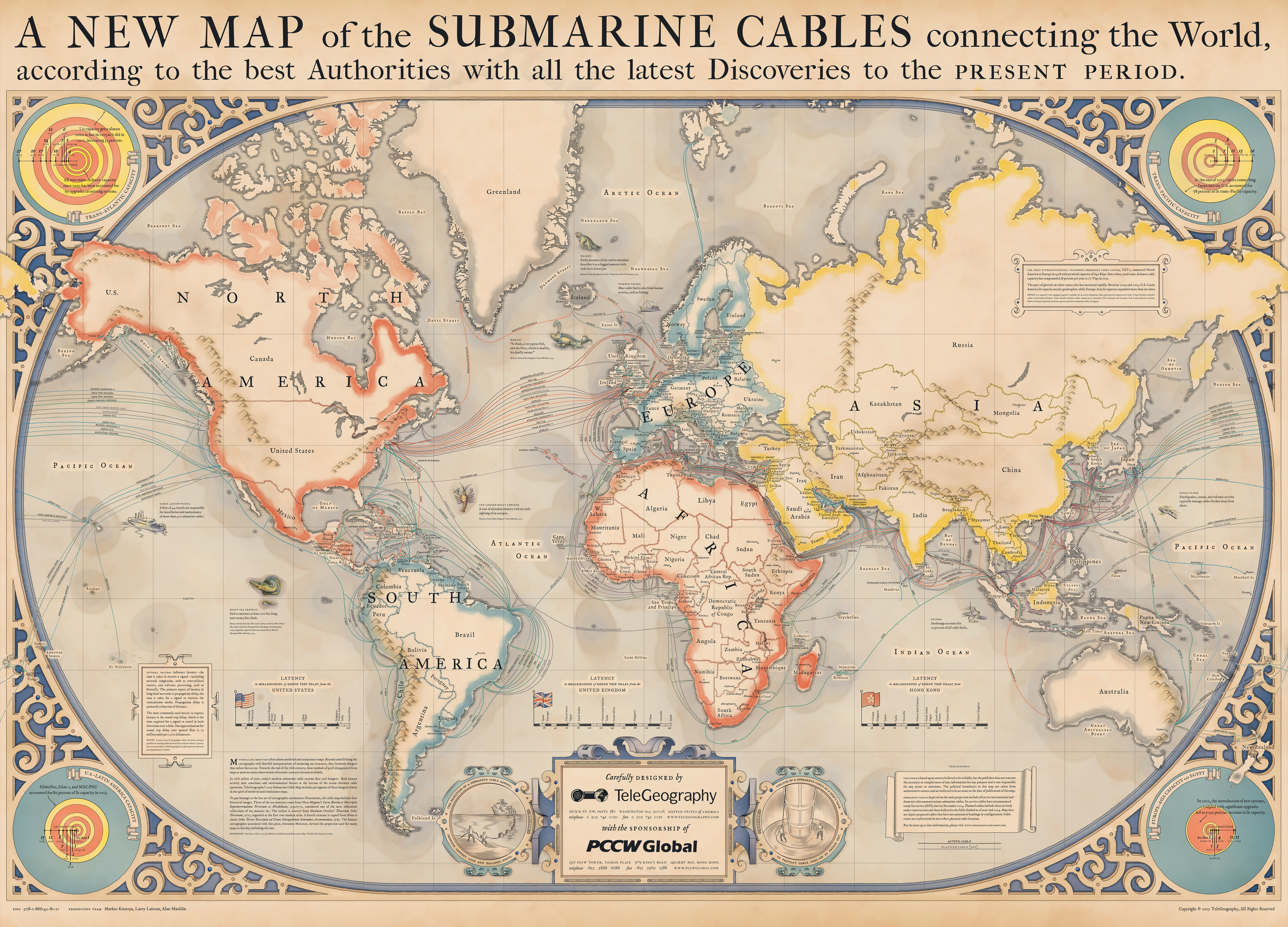
Each year Telegeography makes some awesome submarine cable maps. They've been doing this for some time now, and the versions for year 2013 through 2021 is available here;
They used to be interactive (i.e. you could zoom/pan the entire map), but since 2020 that is no longer possible (as far as I know). They have JPEG-versions available for download in somewhat OK resolution. However, they still seem to use the same system to generate the spinning globe and some other aspects of the website, which makes us able to stitch together maps. Fortunately, the 16K version was available for both 2020 and 2021.
During the last few years, I've stitched these together as high resolution pictures (.png). The initial method was provided by /u/mcgroarty (thanks!). They are listed below in cut versions (letterboxes in top and bottom removed), but uncut versions is also available at the bottom.
My personal favourite is (still) the 2015-version, which I made a custom version of with some minor edits to be better suited for print; I removed the year ("2015") so that it won't be "obsolete", and also made the "sponsored by" logo less intrusive (made it greyscale + removed the ®).
The 2020-version is a close call to the 2015, but I still think the 2015-version is cooler to have on the wall (more "old map"-feeling imho).
- 2013 (cut) (80MB)
- 2014 (cut) (27MB)
- 2015 (cut) (126MB)
- 2015 custom: PNG-version for print (144MB)
- 2015 custom: JPEG-version for preview (27MB).
- 2016 (cut) (13MB)
- 2017 (cut) (178MB)
- 2018 (cut) (49MB)
- 2019 (cut) (49MB)
- 2020 (cut) (135MB)
- 2021 (cut) (31MB)
Uncut versions;
- 2013 (uncut) (90MB)
- 2014 (uncut) (28MB)
- 2015 (uncut) (130MB)
- 2016 (uncut) (14MB)
- 2017 (uncut) (184MB)
- 2018 (uncut) (53MB)
- 2019 (uncut) (49MB)
- 2020 (uncut) (136MB)
- 2021 (uncut) (31MB)
No comments:
Post a Comment