Hi,
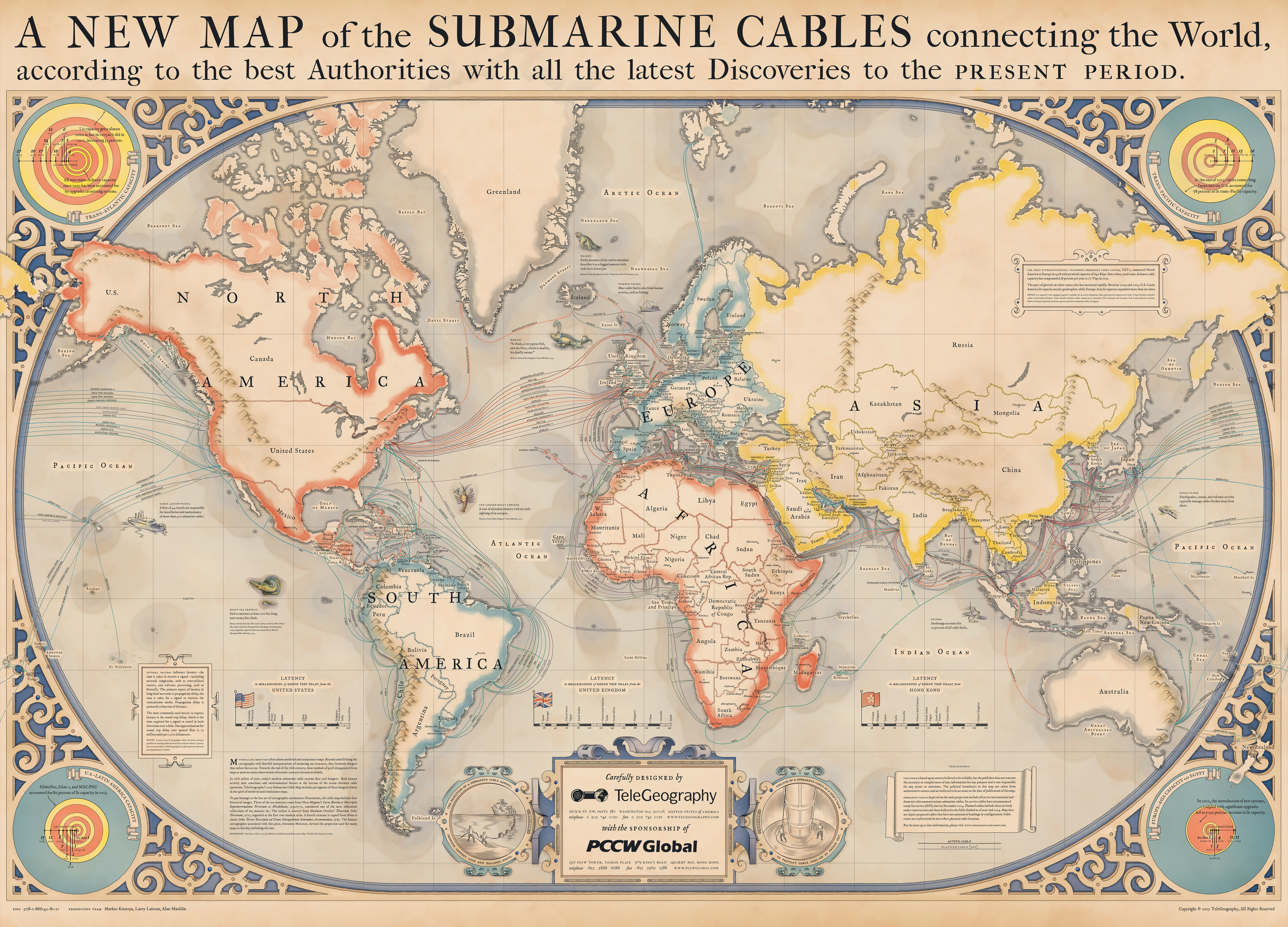
Each year Telegeography makes some awesome submarine cable maps. They've been doing this for some time now, and the versions for year 2013 through 2019 is available here;
During the last few years, I've stitched these together as high resolution pictures (.png). The initial method was provided by /u/mcgroarty (thanks!). They are listed below in cut versions (letterboxes in top and bottom removed), but uncut versions is also available at the bottom.
My personal favourite is the 2015-version. I made a custom version of it, that has some minor edits to be better suited for print -- I removed the year ("2015") so that it won't be "obsolete", and also made the "sponsored by" logo less intrusive (made it greyscale + removed the ®).
- 2013 (cut) (80MB)
- 2014 (cut) (27MB)
- 2015 (cut) (126MB)
- 2015 custom: PNG-version for print (144MB)
- 2015 custom: JPEG-version for preview (27MB).
- 2016 (cut) (13MB)
- 2017 (cut) (178MB)
- 2018 (cut) (49MB)
- 2019 (cut) (49MB)
Uncut versions;
- 2013 (uncut) (90MB)
- 2014 (uncut) (28MB)
- 2015 (uncut) (130MB)
- 2016 (uncut) (14MB)
- 2017 (uncut) (184MB)
- 2018 (uncut) (53MB)
- 2019 (uncut) (49MB)
No comments:
Post a Comment